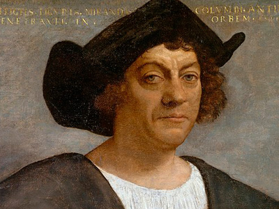
Christopher Columbus (1451-1506)
Quest for Asia
Under the Mongol Empire's hegemony over Asia (the Pax Mongolica, or Mongol peace), Europeans had long enjoyed a safe land passage, the Silk Road, to the Indies (then construed roughly as all of south and east Asia) and China, which were sources of valuable goods such as spices and silk. With the fall of Constantinople to the Ottoman Turks The Ottoman Empire, also known as the Turkish Empire, was an empire that controlled much of Southeast Europe, Western Asia, and Northern Africa between the 14th and early 20th centuries. The Ottomans ended the Byzantine Empire with the conquest of Constantinople in 1453. The Ottoman Empire's defeat and the occupation of part of its territory by the Allied Powers in the aftermath of World War I resulted in its partitioning and the loss of its Middle Eastern territories. in 1453, the land route to Asia became much more difficult and dangerous. Portuguese navigators tried to find a sea way to Asia.
In 1470, the Florentine astronomer Paolo dal Pozzo Toscanelli suggested to King Afonso V of Portugal that sailing west would be a quicker way to reach the Spice Islands, Cathay, and Cipangu than the route around Africa. Afonso rejected his proposal. Portuguese explorers, under the leadership of King John II, then developed the Cape Route to Asia around Africa. Major progress in this quest was achieved in 1488, when Bartolomeu Dias reached the Cape of Good Hope, in what is now South Africa. Meanwhile, in the 1480s, the Columbus brothers had picked up Toscanelli's suggestion and proposed a plan to reach the Indies by sailing west across the "Ocean Sea", i.e., the Atlantic. However, Dias's discovery had shifted the interests of Portuguese seafaring to the southeast passage, which complicated Columbus's proposals significantly.
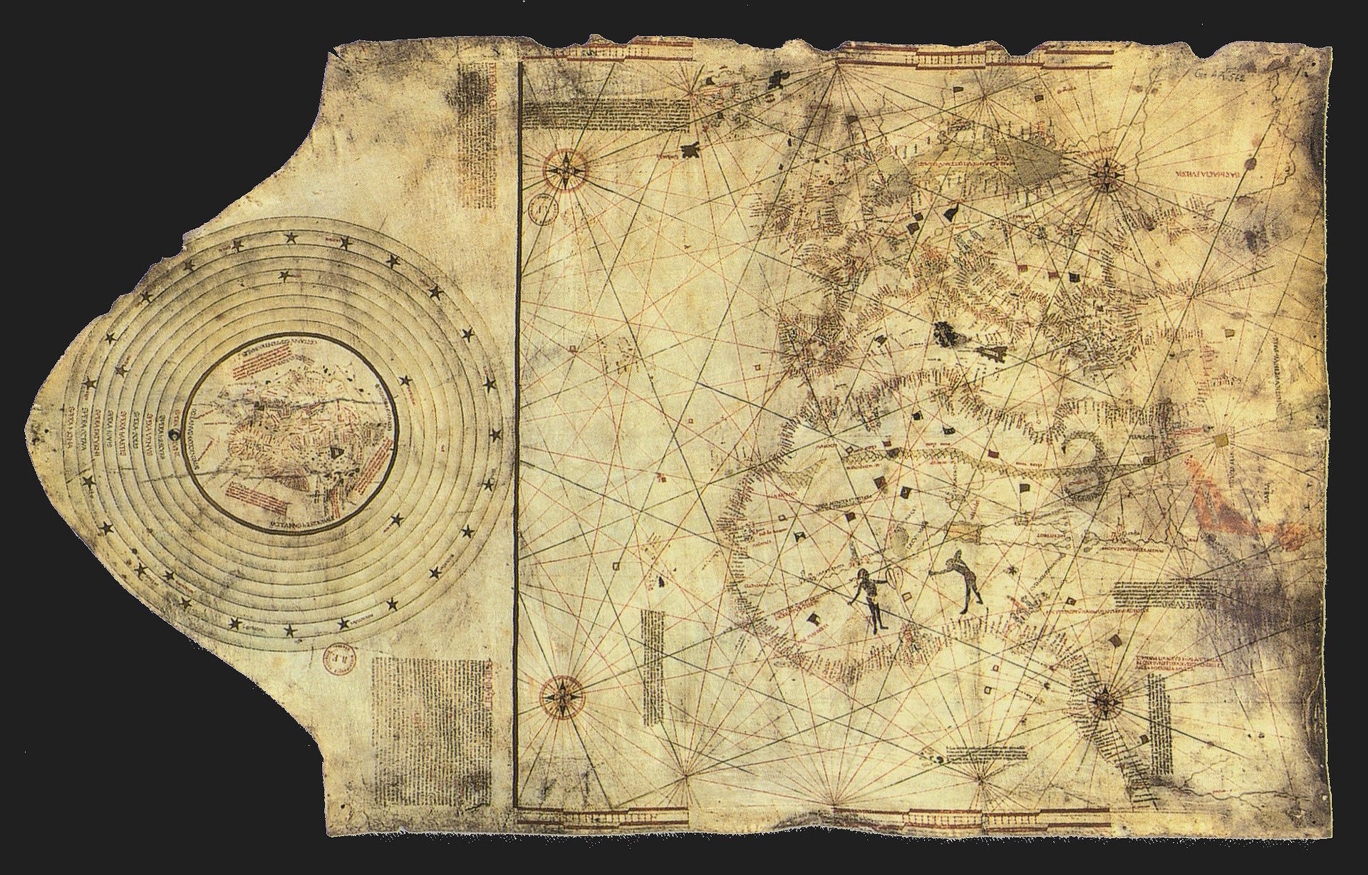
Columbus map, drawn c. 1490 in the Lisbon workshop of Bartolomeo and Christopher Columbus
Geographical Considerations
Washington Irving's 1828 biography of Columbus popularized the idea that Columbus had difficulty obtaining support for his plan because many Catholic theologians insisted that the Earth was flat. In fact, nearly all educated Westerners had understood, at least since the time of Aristotle, that the Earth is spherical. The sphericity of the Earth is also accounted for in the work of Ptolemy, on which medieval astronomy was largely based. Christian writers whose works clearly reflect the conviction that the Earth is spherical include Saint Bede the Venerable in his Reckoning of Time, written around AD 723. In Columbus's time, the techniques of celestial navigation, which use the position of the sun and the stars in the sky, together with the understanding that the Earth is a sphere, had long been in use by astronomers and were beginning to be implemented by mariners.
As far back as the 3rd century BC, Eratosthenes had correctly computed the circumference of the Earth by using simple geometry and studying the shadows cast by objects at two different locations: Alexandria and Syene (modern-day Aswan). Eratosthenes's results were confirmed by a comparison of stellar observations at Alexandria and Rhodes, carried out by Posidonius in the 1st century BC. These measurements were widely known among scholars, but confusion about the old-fashioned units of distance in which they were expressed had led, in Columbus's day, to some debate about the exact size of the Earth.
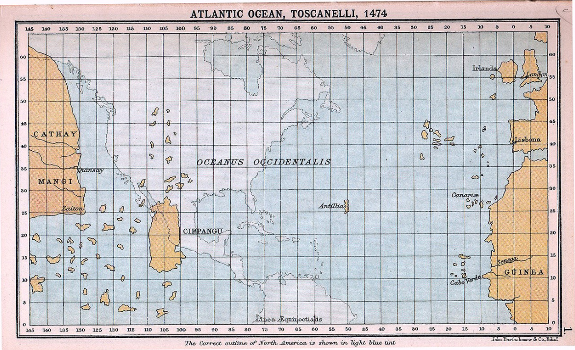
Toscanelli's notions of the geography of the Atlantic Ocean (shown superimposed on a modern map), which directly influenced Columbus's plans
From d'Ailly's Imago Mundi Columbus learned of Alfraganus's estimate that a degree of latitude (or a degree of longitude along the equator) spanned 56⅔ miles, but did not realize that this was expressed in the Arabic mile rather than the shorter Roman mile with which he was familiar (1,480 m). He therefore estimated the circumference of the Earth to be about 30,200 km, whereas the correct value is 40,000 km (25,000 mi).
Furthermore, most scholars accepted Ptolemy's estimate that Eurasia spanned 180° longitude, rather than the actual 130° (to the Chinese mainland) or 150° (to Japan at the latitude of Spain). Columbus, for his part, believed the even higher estimate of Marinus of Tyre, which put the longitudinal span of the Eurasian landmass at 225°, leaving only 135° of water. He also believed that Japan (which he called "Cipangu", following Marco Polo) was much larger, farther to the east from China ("Cathay"), and closer to the equator than it is, and that there were inhabited islands even farther to the east than Japan, including the mythical Antillia, which he thought might lie not much farther to the west than the Azores. In this, he was influenced by the ideas of Florentine astronomer Toscanelli, who corresponded with Columbus before his death in 1482 and who also defended the feasibility of a westward route to Asia.
Columbus therefore estimated the distance from the Canary Islands to Japan to be about 3,000 Italian miles (3,700 km, or 2,300 statute miles). The true figure is now known to be vastly larger: about 20,000 km. No ship in the 15th century could have carried enough food and fresh water for such a long voyage, and the dangers involved in navigating through the uncharted ocean would have been formidable. Most European navigators reasonably concluded that a westward voyage from Europe to Asia was unfeasible. The Catholic Monarchs, however, having completed an expensive war in the Iberian Peninsula, were eager to obtain a competitive edge over other European countries in the quest for trade with the Indies. Columbus's project, though far-fetched, held the promise of such an advantage.
Nautical Considerations
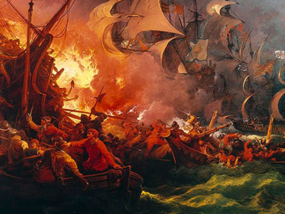
Though Columbus was wrong about the number of degrees of longitude that separated Europe from the Far East and about the distance that each degree represented, he did possess valuable knowledge about the trade winds, which would prove to be the key to his successful navigation of the Atlantic Ocean. During his first voyage in 1492, the brisk trade winds from the east, commonly called "easterlies", propelled Columbus's fleet for five weeks, from the Canary Islands to The Bahamas. The precise first land sighting and landing point was San Salvador Island. To return to Spain against this prevailing wind would have required several months of an arduous sailing technique, called beating, during which food and drinkable water would probably have been exhausted.
Instead, Columbus returned home by following the curving trade winds northeastward to the middle latitudes of the North Atlantic, where he was able to catch the "westerlies" that blow eastward to the coast of Western Europe. There, in turn, the winds curve southward towards the Iberian Peninsula.
It is unclear whether Columbus learned about the winds from his own sailing experience or if he had heard about them from others. The corresponding technique for efficient travel in the Atlantic appears to have been exploited first by the Portuguese, who referred to it as the Volta do mar ("turn of the sea"). Columbus's knowledge of the Atlantic wind patterns was, however, imperfect at the time of his first voyage. By sailing directly due west from the Canary Islands during hurricane season, skirting the so-called horse latitudes of the mid-Atlantic, Columbus risked either being becalmed or running into a tropical cyclone, both of which, by chance, he avoided.
Quest for financial support for a voyage
In 1485, Columbus presented his plans to King John II of Portugal. He proposed that the king equip three sturdy ships and grant Columbus one year's time to sail out into the Atlantic, search for a western route to the Orient, and return. Columbus also requested he be made "Great Admiral of the Ocean", appointed governor of any and all lands he discovered, and given one-tenth of all revenue from those lands. The king submitted Columbus's proposal to his experts, who rejected it. It was their considered opinion that Columbus's estimation of a travel distance of 2,400 miles (3,860 km) was, in fact, far too low.
In 1488, Columbus appealed to the court of Portugal once again and, once again, John II invited him to an audience. That meeting also proved unsuccessful, in part because not long afterwards Bartolomeu Dias returned to Portugal with news of his successful rounding of the southern tip of Africa (near the Cape of Good Hope). With an eastern sea route to Asia apparently at hand, King John was no longer interested in Columbus's far-fetched project.
Columbus traveled from Portugal to both Genoa and Venice, but he received encouragement from neither. He had also dispatched his brother Bartholomew to the court of Henry VII of England The Kingdom of England was a sovereign state on the island of Great Britain from about 927, when it emerged from various Anglo-Saxon kingdoms, until 1 May 1707, when it united with Scotland to form the Kingdom of Great Britain. The Viking invasions of the 9th century upset the balance of power between the English kingdoms, and native Anglo-Saxon life in general. The English lands were unified in the 10th century in a reconquest completed by King Æthelstan in 927. to inquire whether the English crown might sponsor his expedition, but also without success.
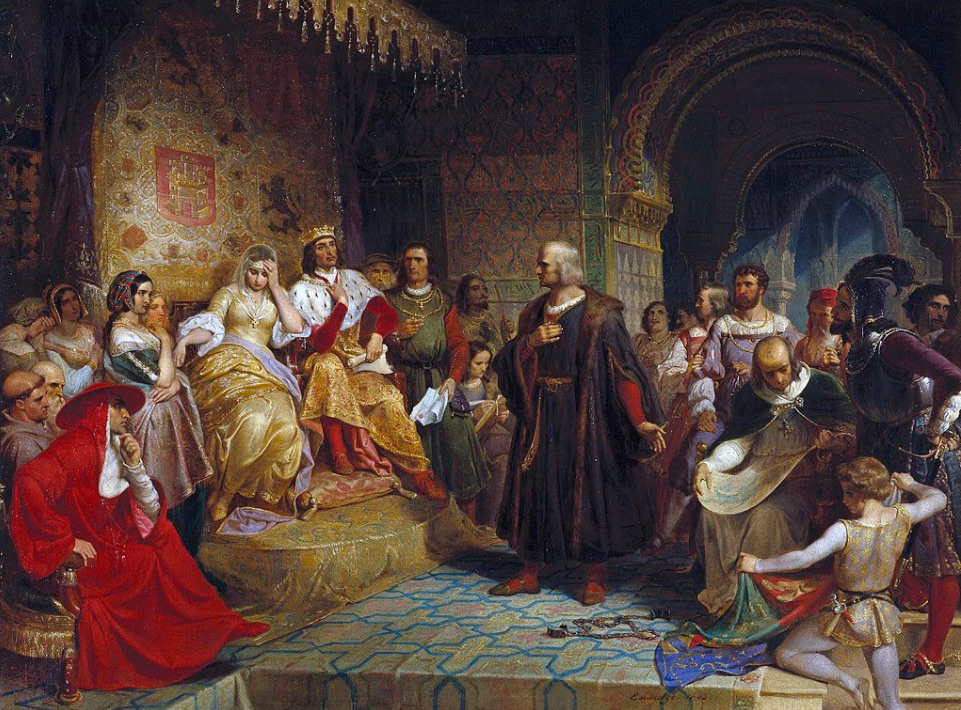
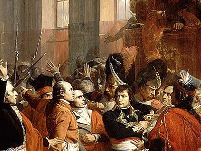
Columbus before the Queen, as imagined by Emanuel Gottlieb Leutze 1843
Columbus had sought an audience from the monarchs Ferdinand II of Aragon and Isabella I of Castile, who had united several kingdoms in the Iberian Peninsula by marrying and were ruling together. On 1 May 1486, permission having been granted, Columbus presented his plans to Queen Isabella, who, in turn, referred it to a committee. After the passing of much time, the savants of Spain, like their counterparts in Portugal, replied that Columbus had grossly underestimated the distance to Asia. They pronounced the idea impractical and advised their Royal Highnesses to pass on the proposed venture.
However, to keep Columbus from taking his ideas elsewhere, and perhaps to keep their options open, the Catholic Monarchs gave him an annual allowance of 12,000 maravedis and, in 1489, furnished him with a letter ordering all cities and towns under their domain to provide him food and lodging at no cost.
Agreement with the Spanish Crown
After continually lobbying at the Spanish court and two years of negotiations, he finally had success in January 1492. Ferdinand and Isabella had just conquered Granada, the last Muslim stronghold on the Iberian Peninsula, and they received Columbus in Córdoba, in the Alcázar castle. Isabella turned him down on the advice of her confessor. Columbus was leaving town by mule in despair when Ferdinand intervened. Isabella then sent a royal guard to fetch him, and Ferdinand later claimed credit for being "the principal cause why those islands were discovered".
In the April 1492 "Capitulations of Santa Fe", King Ferdinand and Queen Isabella promised Columbus that if he succeeded he would be given the rank of Admiral of the Ocean Sea and appointed Viceroy and Governor of all the new lands he could claim for Spain The Spanish Empire was a colonial empire governed by Spain and its predecessor states between 1492 and 1976. One of the largest empires in history, it was the first to usher the European Age of Discovery and achieve a global scale, controlling vast territory. It was one of the most powerful empires of the early modern period, reaching its maximum extent in the 18th century.. He had the right to nominate three persons, from whom the sovereigns would choose one, for any office in the new lands. He would be entitled to 10 percent of all the revenues from the new lands in perpetuity. Additionally, he would also have the option of buying one-eighth interest in any commercial venture with the new lands and receive one-eighth of the profits.
Columbus was later arrested in 1500 and dismissed from his posts. He and his sons, Diego and Fernando, then conducted a lengthy series of court cases against the Castilian crown, known as the pleitos colombinos, alleging that the Crown had illegally reneged on its contractual obligations to Columbus and his heirs. The Columbus family had some success in their first litigation, as a judgment of 1511 confirmed Diego's position as Viceroy, but reduced his powers. Diego resumed litigation in 1512, which lasted until 1536, and further disputes continued until 1790.
HISTORY


RESOURCES
This article uses material from the Wikipedia article "Christopher Columbus (1451-1506)", which is released under the Creative Commons Attribution-Share-Alike License 3.0.
© Stories Preschool. All Rights Reserved.